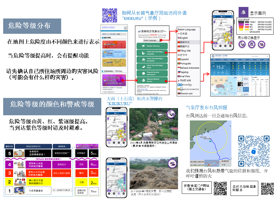
KIKIKURU is a "Danger level distribution" real time map system that shows the risk level of disasters caused by rain in 5 stages on the website of the Japan Meteorological Agency.
KIKIKURU will display "risk distribution" in real time on the map by color-coding the risk of inundation, floods, and landslide due to rain in five stages on its website so that it can be used for voluntary evacuation decisions.
You can be available the leaflet below at Nagasaki meteorological office and Local government in Nagasaki prefecture.
◯KIKIKURU Introduction Video◯
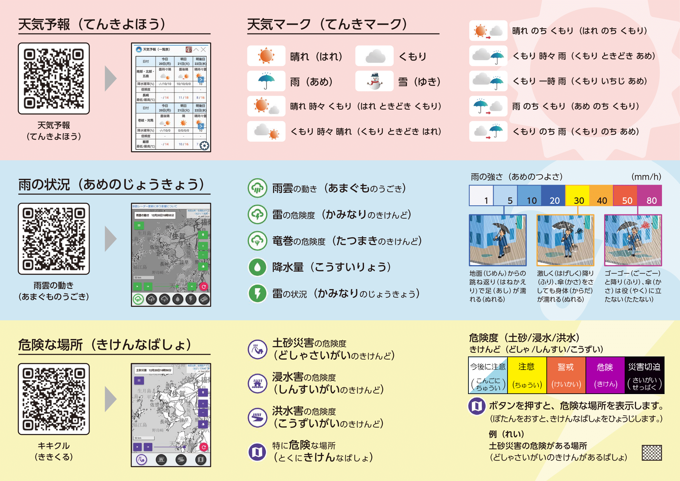
Leaflet in plain Japanese
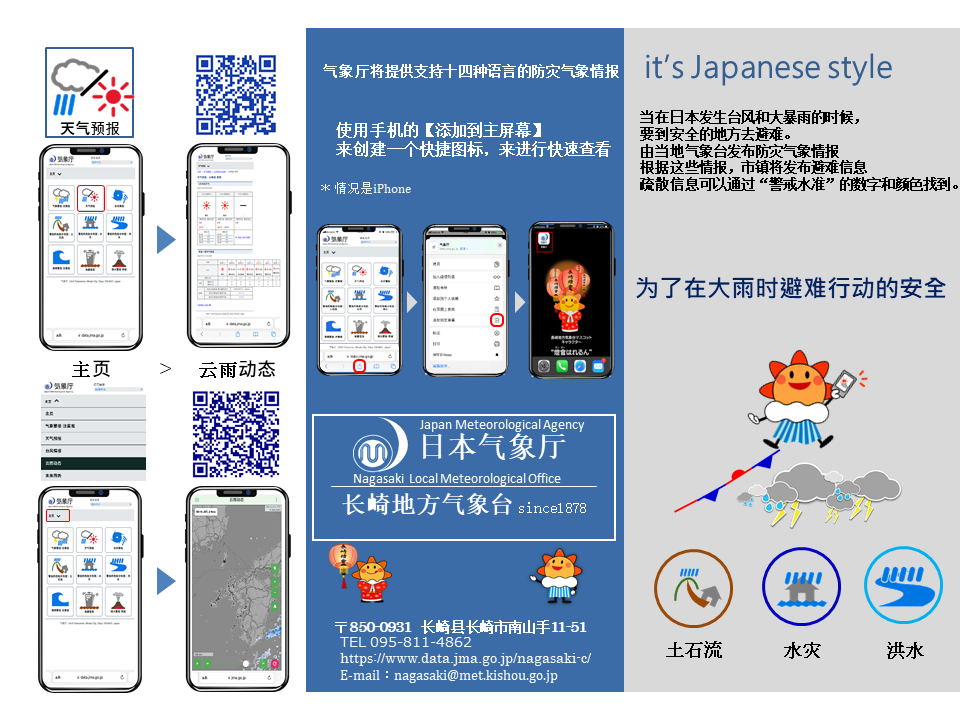
(Check the weather info from your phone.)

(Note: Tap pics to enlarge.)
For safe evacuation during heavy rain [大雨の時の安全な避難行動] Leaflet in 8 Languages
(Note: Tap pics to enlarge.)
🇨🇳 简体中文 PDF:0.8MB PNG:3.03MB
🇨🇳 繁體中文 PDF:0.8MB PNG:2.97MB
🇻🇳 Tiếng Việt PDF:0.6MB PNG:2.87 MB
🇺🇸 English PDF:0.6MB PNG:3.36MB
🇰🇷 한국어 PDF:1.2MB PNG:3.90MB
🇯🇵 Japanese PDF:1.2MB PNG:4.1MB
🇮🇩 Bahasa Indonesia PDF:0.8MB PNG:4.2MB
🇳🇵 नेपाली भाषा PDF:1.3MB PNG:4.0MB
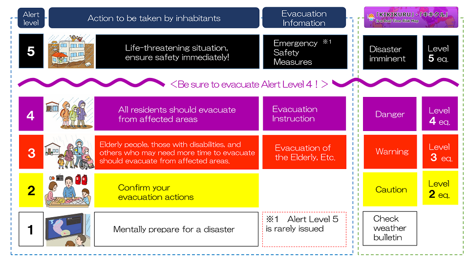
Evacuation actions according to the alert level (8 Languages)
(Note: Tap pics to enlarge.)
🇨🇳 简体中文 PDF:150KB PNG:1.61MB
🇨🇳 繁體中文 PDF:137KB PNG:1.61MB
🇻🇳 Tiếng Việt PDF:168KB PNG:1.68 MB
🇺🇸 English PDF:119KB PNG:1.59MB
🇰🇷 한국어 PDF:170KB PNG:1.55MB
🇯🇵 Japanese PDF:134KB PNG:1.62MB
🇮🇩 Bahasa Indonesia PDF:132KB PNG:1.56MB
🇳🇵 नेपाली भाषा PDF:295KB PNG:1.63MB
Earthquake and Tsunami Safety Leaflet (3 Languages)New!
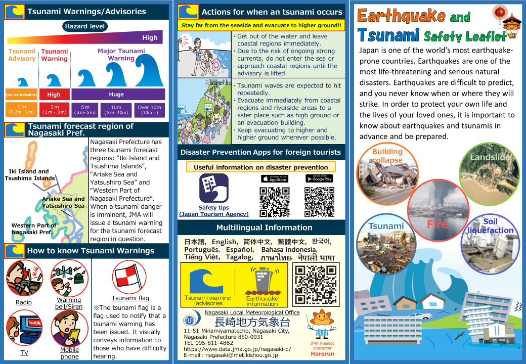
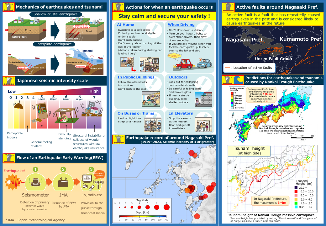
(Note: Tap pics to enlarge.)
🇺🇸 English PDF:1.48MB PNG:6.03MBNew!
🇯🇵 Japanese PDF:2.02MB PNG:6.24MBNew!
🇰🇷 한국어 PDF:1.62MB PNG:6.16MBNew!
Nagasaki International Association
(Note: Tap pics to access the website.)