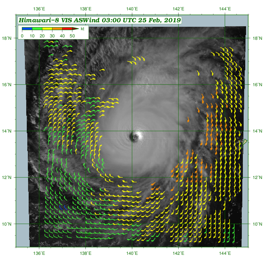
AMV-based Sea-surface Wind
AMV-based Sea-surface Wind data (ASWinds) derived from full-disk and target-area imagery are an ocean surface wind vector product.
In its formulation, wind speeds are estimated from low-level Atmospheric Motion Vectors
(AMVs) based on the strong correlation
between AMVs assigned to the lower troposphere and sea-surface winds around tropical cyclones. ASWinds provides valuable information
on wind distribution around tropical cyclones over the ocean, where observation data are particularly sparse.
Although the accuracy of ASWinds around tropical cyclones has been verified, it is important to understand that their reliability for other regions,
such as around extratropical cyclones, remains unverified.
For further details and results of product validation,
see RMSC Tokyo-Typhoon Center Technical Review (pdf, 2.4MB).
Real-time Monitoring
Up-to-date ASWinds images are available on the MSC website. The real-time monitoring page can be accessed here or on the image below.
Data Dissemination (NMHSs only)
Gridded ASWinds data are provided to National Meteorological and Hydrological Services (NMHSs) via the JMA Data Dissemination System (JDDS)
in SATAIDWIND format (binary), and can be displayed on satellite imagery using the SATAID (SATellite Animation and Interactive Diagnosis) application.
ASWinds are produced from using Himawari-8/-9 low-level AMVs derived from visible (0.64µm) and infrared (3.9µm and 10.4µm) imagery.
For more information, see the Himawari JDDS website (https://www.jma.go.jp/jma/jma-eng/satellite/jdds.html).
| Observation area | Sample data | Remarks |
|---|---|---|
| Target area | aswind_tgvs_201902250300.bin (60kB) | VIS, 0.1 deg |
| aswind_tgir_201902250300.bin (23kB) | IR, 0.1 deg | |
| Full-disk area | aswind_fdvs_201902250300.bin (751kB) | VIS, 0.25 deg |
| aswind_fdir_201902250300.bin (707kB) | IR, 0.25 deg | |
| Full-disk imagery data SATAID format (65N-65S,70E-210E) |
VS20190225.Z0300.gz (gzip, 8.6MB) | VIS (0.64 µm) |
| IR20190225.Z0300.gz (gzip, 5.8MB) | IR (10.4 µm) |
- SATAIDWIND (SATAID wind data) format (pdf, 414kB)
- User's guide for displaying ASWind data in SATAID software (pdf, 1.9MB)
- SATAID Service (WIS-Portal -GISC Tokyo website)
References
- Nonaka, K., S. Nishimura, and Y. Igarashi, 2019: Utilization of Estimated Sea Surface Wind Data Based on Himawari-8/9 Low-level AMVs for Tropical Cyclone Analysis., RSMC Tokyo -Typhoon Center Technical Review, 21. Available at: https://www.jma.go.jp/jma/jma-eng/jma-center/rsmc-hp-pub-eg/techrev/text21-3.pdf
- Shimoji, K., 2017: Introduction to the Himawari-8 Atmospheric Motion Vector Algorithm., Meteorological Satellite Center Technical Note, 62, 73-77. Available at: https://www.data.jma.go.jp/mscweb/technotes/msctechrep62-4.pdf
- WIS Portal -GISC Tokyo HP, Tokyo Global Information System Center for the WMO informaiton System