Sixth Asia/Oceania Meteorological Satellite Users' Conference Summary
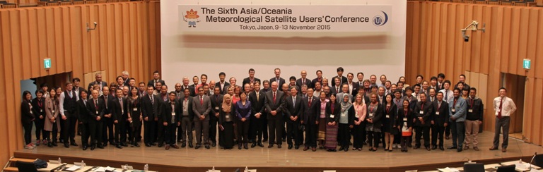
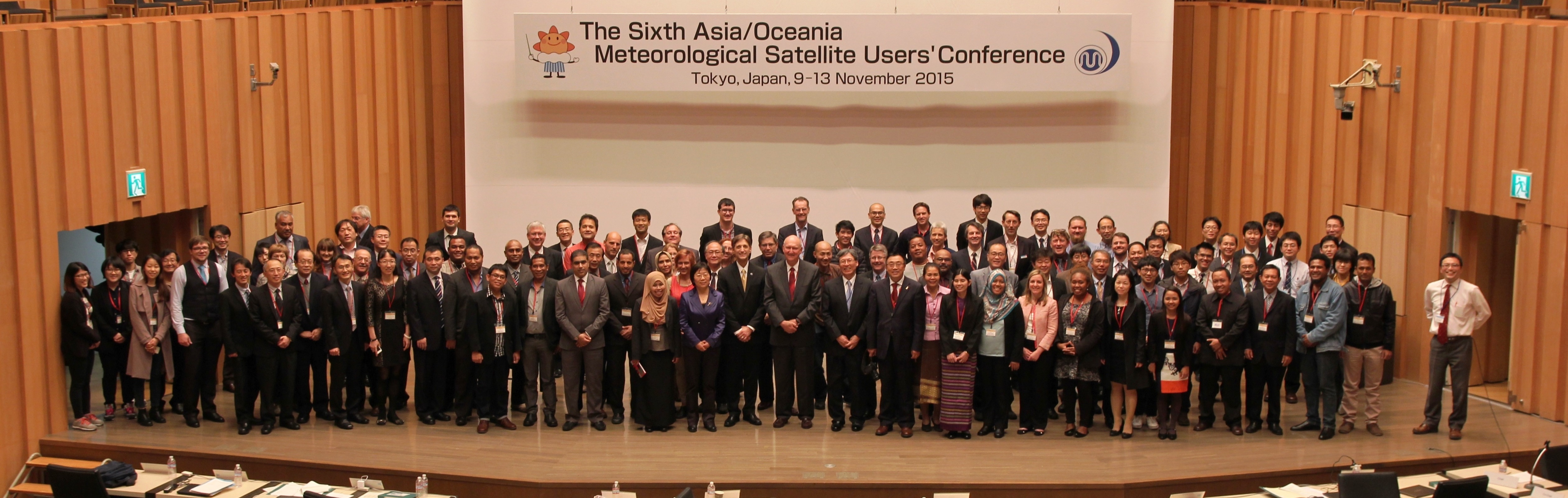
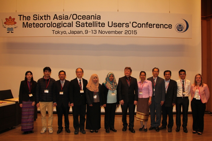
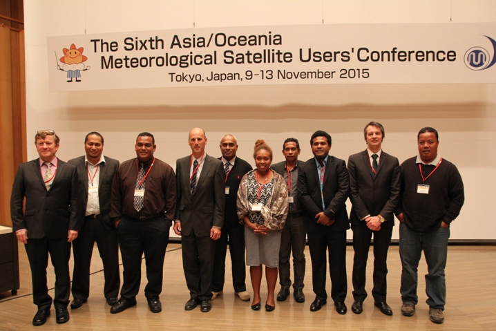
The sixth Asia/Oceania Meteorological Satellite Users' Conference (AOMSUC-6) was held in Tokyo, Japan from 10 - 12 November 2015. The conference was hosted and sponsored by the Japan Meteorological Agency (JMA), and was co-sponsored by the China Meteorological Administration (CMA), the Korea Meteorological Administration (KMA), the Australian Bureau of Meteorology (AuBOM), the Roshydromet of the Russian Federation, the World Meteorological Organization (WMO), and the Group on Earth Observations (GEO). A training event was conducted prior to and following the conference (summarized in the conclusions) that brought together participants from WMO Regions II and V. Over 170 scientists, users, and satellite operators representing 37 countries participated in the AOMSUC-6. All attendees expressed their great appreciation of the outstanding efforts of JMA in its planning and hosting of the conference as well as the support of the co-sponsors and the work of the International Conference Steering Committee (ICSC).
Noting that the successful launch and operation of Himawari-8 in 2014 inaugurated and new era in the Space Based Component of the WMO Integrated Global Observing System (WIGOS), the participants welcomed the efforts being undertaken to introduce and utilize an unprecedented stream of new data; it was agreed that this early coordination in the generation of new products and services and the preparation for their utilization by the worldwide user community must be energetically sustained. It will be a significant undertaking for the operational space agencies in the coming years and these annual conferences of the Asia/Oceania satellite community are an important part of that effort.
The conference was opened by Mr Noritake Nishide, Director-General of JMA. Director-General Nishide welcomed the participants and noted that this conference was building on the past success of the last five conferences and was pleased that the success of Himawari-8 gave the conference a new focus in training. He stressed the importance of this conference as an opportunity for enhancing cooperation, exchanging information, and improving satellite data utilization. In their welcoming remarks, Ms Caiying Wei, Deputy Director General, National Satellite Meteorological Center, CMA, Dr Sang Jin Lyu, Director, Satellite Analysis Division, KMA, Dr Anthony Rea, Assistant Director, Observing Strategy and Operations, AuBoM, Ms Liubov Kramareva, Director of the Far Eastern Center of SRC Planeta, Roshydromet, all reflected on the importance of the AOMSUC's in bringing together satellite operators and the user community. All noted the increasing efforts to engage the user community and to offer training on site and remotely in order to achieve improved satellite data utilization. Dr Barbara Ryan, representing GEO via a video presentation, noted that AOMSUC continues as an important mechanism for enhancing scientific understanding through international cooperation and collaboration. Dr Wenjian Zhang, Director of the WMO Observation Department, lauded the vibrancy of the Asia/Oceania meteorological satellite community, complimented them for their good efforts in sharing data and information across the region, and renewed the WMO commitment to support this and future AOMSUCs. He reiterated that the increase in satellite data quality, volume, and information content presents a challenge to the community to realize the opportunity for improved weather and climate services.
Session 1, "Current and future meteorological satellite programs," was chaired by Dr Wenjian Zhang (WMO) and Mr Toshiyuki Kurino (JMA). Six speakers provided information about the plans of the operational space agencies (EUMETSAT, JMA, KMA, NOAA/NESDIS, NSMC/CMA and ROSHYDROMET), preparations for use, and anticipated impact on the WMO Global Observing System (GOS). All agencies are working towards continuity and improvement of satellite data services (calibration, demonstration of new applications, access to data and products, and training). Japan's first of the new generation of geostationary satellite imagers, the Advanced Himawari Imager, is providing unprecedented new and exciting multispectral measurements. NMSC/CMA is planning launch of the FY-3 and FY-4 series (FY-4A in 2016 will introduce geostationary satellite high spectral resolution infrared (IR) measurements along with a geo test of microwave technology). Additional plans for the rest of this decade include MTG and EPS-SG by EUMETSAT; Himawari-9 by JMA, GEO-KOMPSAT-2A and B by KMA; GOES-R and JPSS by NOAA/NESDIS; ELECTRO-L and -M geostationary-series (the latter will include a geo FTS) and Meteor-MN3, Meteor-MP LEO-series and Arctica in a Molniya orbit by Roshydromet. CMA in proceeding with plans to cover the early morning polar orbit with FY-3; this has been noted to be of significant benefit to the WIGOS and NWP in particular. Global imaging from geostationary orbit will be enhanced with five more high quality imagers. Addressing the challenge of making use of the new data, AuBOM is introducing new product utilization opportunities to the Asia/Oceania community using VLab and other mechanisms. From the WMO perspective, it was noted that these satellite plans bring to fruition many of the recommendations from the Expert Team on the Evolution of the GOS. In his session opening presentation, ICSC Chair Dr James Purdom noted the frequent multispectral high spatial resolution data presents a challenge for image analysts and offered examples of the effectiveness of Principal Component de-construction.
Session 2, "Himawari-8, related status and application," was chaired by Dr Ken Holmlund (EUMETSAT) and Mr Toshiyuki Kurino (JMA). The Advanced Himawari Imager on board Himawari-8 (AHI-8), its performance, and specific applications were presented. AHI, the first of a series of same instruments with minor differences in channel selection, was deployed in 2014; additional satellites with comparable imagers include Japans Himawari-9, the US GOES-R, and Koreas GEO-KOMPSAT-2 satellites. The innovative design allows for flexible scan strategies e.g. full disk with a 10 minute repeat cycle and two dedicated rapid scan sectors. Its in-orbit performance is excellent with an image navigation accuracy of 1 km and calibration accuracy of 0.2 K. This enables the derivation of Atmospheric Motion Vector (AMV) with improved quality over the predecessor satellite MTSAT-2 with an associated strengthened positive impact of AMVs on the JMA Numerical Weather Prediction model. Furthermore the increase in resolution and number of channels presents new opportunities for multi-spectral analysis of weather phenomena. The impressive results shown in the session unequivocally demonstrate the great advances that can be made with the new generation geostationary satellites that will be launched in the coming years by several satellite operators.
Session 3, "JAXA's coordinated efforts for the earth's environmental monitoring," was chaired Dr Teruyuki Nakajima (JAXA) and Mr Toshiyuki Kurino (JMA). Presentations were given on Global Satellite Mapping of Precipitation and aerosol retrieval and wildfire detection improvements with Himawari-8. It was noted that these research data sets were now available to the general public. Finally a report on the close cooperation of Australia and Japan toward maximizing the applications and benefits from Himawari data was given.
Three sessions on Country Reports from Southeast Asia, Oceania, South Asia, Middle east, and Central Asia were chaired Bodo Zeschke (AuBOM), Anthony Rea (AuBOM), Agnes Lane (AuBOM), Joachim Saalmueller (EUMETSAT), and Kenneth Holmlund (EUMETSAT). Twenty six countries presented their major weather challenges; tropical storms, typhoons, excessive rainfall, flooding, and landslide were repeatedly mentioned.
Country reports from Southeast Asia were received from the Kingdom of Cambodia, Hong Kong, Republic of Indonesia, Lao People's Democratic Republic, Malaysia, Republic of the Union of Myanmar, Republic of the Philippines, Republic of Singapore, Kingdom of Thailand, and Socialist Republic of Viet Nam. Satellite data is very important in many of the countries for the detection and monitoring of high impact weather and atmospheric phenomena such as Typhoons, thunderstorms, dust, volcanic ash etc. due to the paucity of other observations. For many of the countries there are issues in the access of the data due to limited reception facilities, limited bandwidth and a lack of knowledge of the online resources. In response a number of online resources were presented by some satellite providers and attendees in the audience. Users were encouraged to be more proactive in asking satellite providers for the required data. In addition the importance of collaboration with the RAV Task Team on Satellite User Requirements was mentioned. The countries want to have the freedom to modify the products for their own local conditions. Conference attendees recognised that there could be a problem in developing different data products for the planned overlapping geostationary satellites over the Asia/Pacific region. In this context reference was made to the WMO SCOPE-Nowcasting initiative. Finally, the importance of training courses that "Train the Trainer" was emphasized by some of the presenters.
Country reports from Oceania were received from the Democratic Republic of Timor-Leste, Fiji Meteorological Service, Federated States of Micronesia, Meteorological Service of New Zealand, Papua New Guinea National Weather Service, Solomon Islands Meteorological Service, Tonga Meteorological Service, and Tuvalu Meteorological Service. For a number of the countries in Oceania, the lack of in situ observing systems means that satellites are often the primary tool for nowcasting and warning services. Key themes emerging from the discussion were the urgent need for training in satellite products, particularly new products emerging from Himawari-8. Participants also highlighted the need for easy-to-use products. Lack of sufficient internet bandwidth to access satellite products remains an issue for some countries. The contribution of Japan in terms of HimawariCast was recognized as a very significant contribution to the Region. In addition to geostationary data, scatterometer data is an important input to forecasting and warning services for most countries in the region.
Country reports from South Asia included the People's Republic of Bangladesh, Kingdom of Bhutan, Republic of Maldives, Islamic Republic of Pakistan, Democratic Socialist Republic of Sri Lanka; from the Middle East and Central Asia reports were heard from the Kyrgyz Republic, Sultanate of Oman, and Republic of Uzbekistan. Many countries share the same top hazards, typically being tropical storms, severe thunderstorms and monsoon with related impact through torrential rain, flash floods and land-slides. For Island Nations and coastal regions a particular challenge is the sea-level rise induced by climate change. However, some challenges are quite diverse due to the geographical situation like avalanches and glacier lake outburst floods for Kyrgyzstan and Uzbekistan in their high mountain areas, drought in Pakistan and Uzbekistan and dust storms affecting Oman.

Discussion after the presentations concluded that joint challenges include infrastructure, overall level of resources, and for some sustained operations through critical weather events. Whilst satellite observations are a key for monitoring, prediction and analysis of the top hazards, severe limitations exist due to lack of sufficient bandwidth for data access, available computing power for data analysis and in particular lack trained experts in satellite meteorology. The training needs are highly diverse as well, including: (1) basic training in developing a resilient reception, processing and visualization infrastructure, (2) training on generation and applications of specific products derived from the multispectral imagers available from the new generation GEO imagers in conjunction with Nowcasting and short-range NWP. Hence it is felt that training is and will be one of the major challenges, particularly noting some of the diverse needs, and education on availability of data and tools on the internet, is highly important. The VLab Centers of Excellence offer a variety of training opportunities and gather training requirements on a regular basis e.g. in form of regional focus group meetings. A continued challenge will be to devise organizational mechanisms for developing skills for a smaller sub-regional set of NMHSs with similar training needs. Models for such cooperation exist. Furthermore training should be active, not reactive; it should be strongly founded on the physical properties of the observations and should increasingly use polar orbiting data too. Finally, several countries are deploying new systems for improving on the above limitations, however the advent of the new generation of meteorological satellites make the technical challenges more severe, if these satellites were to be efficiently exploited. The most frequently used tools are multi-spectral images (RGBs) and image animations, where available rapid scanning.
Session 4, "Program plans, data access and utilization," was chaired by Drs Paul Menzel (UW/CIMSS) and James Purdom (CIRA). NOAA's Joint Polar Satellite System (JPSS) was briefed and societal benefits being realized from Suomi NPP were presented. These include volcanic ash detection, monitoring drought conditions, tracking dust and smoke, detecting ice flows and blockages in Arctic regions, monitoring the health of coral reefs, and many more. The GOES-R Proving Ground was noted to have prepared users of the Advanced Baseline Imager by demonstrating the new applications with data from Himawari-8; utilization of the geo lightning mapper has also been advanced. The LEO and GEO components of the Community Satellite Processing Package (CSPP is a freeware package) were presented with emphasis on their utility for direct broadcast users. A web site summarizing the CrIS instrument data quality and associated issues was introduced. And an improved INR system developed for COMS was offered as an opportunity for regional collaboration on improving image navigation and registration performance with regard to accuracy and timeliness.
Session 5, "Atmospheric parameters derived from satellite observations," was chaired by Drs Mitch Goldberg (NOAA/NESDIS) and Myoung-Hwan Ahn (Ewha Womans University). The focus was on the derivation of cloud and precipitation from geostationary and polar orbiting satellites. Multiband, frequent observations by the Himawari-8/AHI, GEO-KOMPSAT-2A/AMI and other geostationary satellites will enable to study diurnal cycle of cloud system and cloud evolution during their lifetime. A multiband infrared and visible cloud retrieval based on the optimal estimation method was discussed to provide consistent cloud-property retrievals, which fits physics-based model simulations to the observation signals. A suite of cloud, aerosols, surface, and radiation products derived using the Clouds from AVHRR Extended Processing System (CLAVRX) was discussed. CLAVRX currently operates on AVHRR, MODIS and AVHRR and is part of the Community Satellite Processing Package (CSPP) and will be extended to CSPP geostationary package. CLAVRX will provide consistent products from a suite of imagers and is available to the entire community. The community is encouraged to use CLAVRX as a possible reference in comparing the accuracy of cloud, surface, and aerosol algorithms. KMA has started the development of GK-2A meteorological products for applying weather forecast, NWP, climate monitoring in July 2014. Significant work is underway in preparation for the 2018 launch of the AMI. Finally two papers on geostationary rainfall rates were presented. Both papers acknowledge the importance of the more accurate polar-orbiting microwave rain rates to calibrate the geostationary infrared-based rainfall products especially for warm and shallow precipitating clouds.
Session 6, "Application of satellite data to weather analysis and disaster monitoring," was chaired by Mr Ken Carey (Earth Resources Technology, Inc.). In seven presentations the following highlights emerged. An Integrated Calibration and Validation System (ICVS), developed by NOAA, provides real time status of environmental satellite health/instrument performance/data product quality; the system also delivers long term trending of NOAA instruments and automated warning messages when anomalies are detected. Detection of overshooting tops (OTs) was presented as a useful indicator of severe weather conditions such as lightning, large hail, high winds, heavy rainfall, and severe turbulence and icing; detection methods include a Water Vapor-InfraRed window channel Brightness Temperature Difference (WV-IRW BTD) approach and an InfraRed Window texture (IRW-texture) method. Machine learning approaches with various variables from geostationary satellite data such as MSG/SEVIRI (over Africa) and Himawari/AHI (over East Asia) have been used to improve OT detection. CloudSat and lightning data demonstrated promise in predicting the spatial and temporal extent of OTs. Retrieval of total precipitable water (TPW) from the Advanced Microwave Imager data using a statistical approach, an Artificial Neural Network (ANN), was presented; using AHI data demonstrated potential in assessing the areal, intensity, and extent of TPW. Inflight icing detection with machine learning techniques applied to COMS/MI and Himawari-8/AHI satellite data showed improvement when icing thresholds were adjusted empirically. The Dvorak tropical cyclone intensity adjusted for Himawari-8 data was presented; when supplemented with microwave imagery and scatterometer data, better tropical cyclone evaluation and forecasts were realized. Positive results for hail and rainstorm detection were demonstrated when adding data from microwave sounders carried by NOAA and FY-3 to that from VIS/IR imagers. Fengyun-4 (FY-4) will soon feature complete three-dimensional observations with high temporal, spatial and spectral resolutions; progress of the space- and ground segments of FY-4A was also discussed. New data and product service plans include data broadcasting and sharing, product distributing and emergency observation support, which will benefit the user community.
Session 7, "Application of satellite data to numerical weather prediction," was chaired by Drs Fuzhong Weng (NESDIS/STAR) and Kozo Okomoto (JMA). Presentations covered various data assimilation topics. A report on assimilation of current GEO radiances in Hurricane Weather Research and Forecast (HWRF) featured the vetting of AHI thermal channels for direct radiance assimilation. Positive impacts of assimilation of AHI motion vectors in JMA regional NWP on precipitation and typhoon forecasts were demonstrated. Activities of satellite data assimilation in UK global, in both regional and ocean data assimilation systems, were also highlighted. A plan for conducting an Observing System Simulation Experiment (OSSE) was briefed; the ECMWF nature run will be used for truth and the impacts of smaller CrIS FOV size on NWP forecast skills will be studied.
Session 8, "Application of satellite data to climate and environmental monitoring," was chaired Ms Caiying Wei (CMA). Presentations noted improved efforts within NOAA to build high quality sensor data records; cross calibration of sensors has been carefully performed to good effect for long term time series of measurements. Extreme rainfall characterized with TRMM precipitation data was linked to the wet phase of the Madden-Julian Oscillation; evolution of OLR and circulation anomalies was also found to be associated. Five years of GOCI aerosol retrievals have been re-calibrated via two field campaigns; understanding of the AOPs over major cities has been increased by intercomparison with ground based sun photometer measurements. It was noted that useful data sets for climate and environmental monitoring are emerging through efforts like those presented here.
Session 9, "Land surface and ocean parameters derived from satellite observations," was chaired by Drs Anthony Rea (AuBOM) and Adam Lewis (Geoscience Australia). Four interesting presentations covered land and ocean applications of polar orbiting satellites offering globally consistent data. Noted was the use of TRMM to determine surface emissivity, use of AMSR-2 for ocean products, the operational use of Rapidscat (recently deployed on the International Space Station), and a multi-sensor approach the sea surface temperature analysis. The talks in this session demonstrated the complementary nature of geostationary and polar orbiting data and, in particular, the additional VIS/NIR/IR detail available from polar orbiting sensors and cloud penetrating microwave data. The data from these instruments, whilst less frequent than geostationary images, provide additional information on storm structures and other phenomena. The ability of AMSR-2 to fill in the gaps in infrared SST products arising from persistently cloudy areas was noted. Issues associated with the introduction of new products into operations were discussed; easy data access and display, training of users and trainers, and collocating product developers and researchers with the users of products are very important.
Session 10, "Capacity building and training activities," was chaired by Dr Sang Jin Lyu (KMA/NMSC) and Mr Bodo Zeschke (AuBoM). Three presentations focused on training program and application to ensure user readiness for the new generation satellites. AuBoM has launched "Himawari-8 Training Campaign" in January 2015 as a VLab Center of Excellence to assist Australian Bureau of Meteorology, WMO Region V and other regions in preparation for the effective use of Himawari-8 data. AuBoM has been providing valuable training courses timely for RA II and V. The US NWS invested in a new prototype training method where trainers are dispatched to the field office to lead forecasters in several four-hour sessions over two or three days. The NWS Guam Himawari training was outlined with the training software (SIFT) application and future uses of this training delivery method for the GOES-R/ABI. The National Institute of Information and Communications Technology of Japan (NICT) introduced "The Asia-Oceania online Users Forum for the Himawari-8 Real-time Web Application" to transfer, process and visualize data through an web application (http://himawari8.nict.go.jp/) with a concept of "get real-time climate view anywhere and anytime." Many volunteers are anticipated to come up to make this application available in multiple languages. It was also pointed out that many CoEs in different regions need to cooperate more closely to meet the users' requirements more effectively. These excellent efforts in the direction of capacity development were lauded but it was realized that the energy level must be sustained.
In the poster session, 34 posters detailed new developments in sensor calibration, cloud detection and characterization, wind retrievals, dust detection, fire monitoring, nighttime sea fog detection, convective initiation characterization, rainfall estimation, NWP improvements resulting from satellite data usage, and several other topics. The session produced spirited discussion, initiated new collaborations, and provided further opportunity for useful information exchange.
AOMSUC-6 featured high quality presentations in 10 oral sessions, 26 country reports, a poster session with 34 posters, and a concluding panel to summarize the highlights. Each of the co-sponsors expressed appreciation of the conference accomplishments and stressed the importance of continuing the AOMSUC as a future venue. Further, it was announced that India and Indonesia had expressed interest in joining as an AOMSUC co-sponsor, thus expanding the reach of these conferences. Toward continuation, KMA announced that they are making arrangement to host the next AOMSUC at the end of October or early November 2016 and invited prospective attendees to Seoul. Dr James Purdom, Chair of the ICSC, reviewed a statement of resolve from AOMSUC-6 to continue the AOMSUCs, the mechanisms for continuation, and terms of reference of the hosting institute, co-sponsors, the ICSC and a AOMSUC supporting secretariat.
As noted earlier in this summary, in conjunction with AOMSUC-6, a Training event was hosted by JMA on 9 and 13 November 2015. The objectives of the workshop were a) to provide details on the next generation of satellites to assist with user preparedness, b) to give users an appreciation of the various applications of meteorological satellite data and products, and c) to provide participants with the skills to apply meteorological satellite observations to weather analysis, climate monitoring, and environment and disaster management. On the 9th the workshop was attended by 78 participants from 36 countries, while on the 13th there were 54 participants from 32 countries. The workshop lecturers provided information on current and future satellite data, as well as the application of this data for weather and climate analysis, land and ocean monitoring, and disaster mitigation. Presenters also provided information on how to access to data and products, such as via HimawariCast, and tools to interrogate the data, such as via HYDRA2. Another common theme of the workshop was user preparedness for the next generation of satellite systems, and related to this, information was provided on the activities of the WMO Task Teams on Satellite Utilization.
The annual AOMSUC continues to be an excellent forum for members within the Asia/Oceania community to meet and enhance their joint efforts in the utilization of satellite data and products for improved weather and climate services. The current activities and plans presented by the satellite operators in Asia/Oceania continue to be most impressive featuring cutting edge geostationary satellite imagers from JMA, KMA, and CMA that will be capable of multispectral measurements at high temporal and spatial resolution with rapid scan as a routine part of their operation. In addition CMA is introducing the first hyperspectral infrared geostationary satellite sounder. The operational and research satellite communities and users within Asia/Oceania are continuing their close cooperation with great benefit of all.
In summary AOMSUC-6 was very successful in meeting the four goals of these conferences; (1) to promote the importance of satellite observations and highlight their utility, (2) to advance satellite remote sensing science by enabling scientist to scientist information exchanges focused on Asia/Oceania, (3) to provide a means for satellite operators to interact directly with the user community concerning current and future satellite related activities and plans, and (4) to engage young people entering into the field.