Typhoon Monitoring
Visible (B03) imagery from Himawari-8 (150-second intervals) [MP4, 5 MB]
As typhoons often form over the Pacific Ocean south of Japan where observation points are scarce, JMA’s Himawari satellites play a significant role in related monitoring of development, movement and intensity.
Typhoon Chaba (T1618) was upgraded from tropical cyclone to typhoon status at 06:00 UTC on 29 September 2016 west of the Mariana Islands before developing a central pressure of 905 hPa and a maximum wind speed of 60 m/s at 09:00 UTC on 3 October, and approaching Okinawa with fierce intensity.
High-resolution visible images from Himawari-8 clearly show eddies of low clouds in the eye of the typhoon. Typhoon warnings were issued during its approach to Okinawa, and a maximum wind speed of 48.1 m/s (maximum instantaneous wind speed: 59.7 m/s) was recorded at Kumejima Airport in Okinawa Prefecture.
Surface Wind Monitoring Using Satellite Imagery
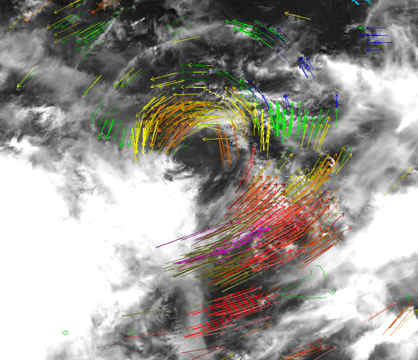
Atmospheric motion vectors (AMVs) derived from geostationary satellite imagery provide frequent and wide-ranging wind distribution information for areas over the ocean. In particular, Himawari-8 AMV-based Sea-surface Winds (ASWinds), estimated from low-level AMVs around tropical cyclones have been utilized at the RSMC Tokyo-Typhoon Center for analysis of such phenomena since July 2017.
Reference
- JMA: Tropical Cyclone Information, JMA website
- JMA: RSMC Tokyo-Typhoon Center, JMA website