Sea Ice Monitoring

Sea ice in the vicinity of Japan is observed mainly in the Sea of Okhotsk and along the Strait of Tartary.
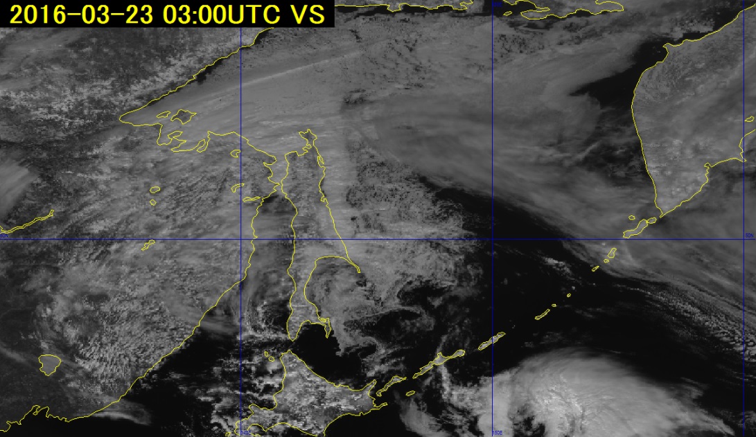
Figure 1 shows an infrared image (10.4 μm) at 03 UTC on 23 March 2016. Sea ice in such imagery is often unclear because the temperature of the ice is similar to that of surrounding low clouds and sea water.
Figure 2 shows a visible image from the same time. Although sunlight reflections give sea ice a light-grey appearance similar to that of low clouds, ice be identified in moving imagery due to its slower flow.
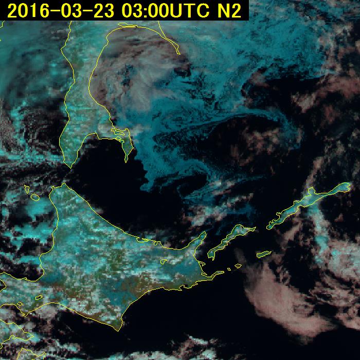
Figure 3 shows a Natural Color RGB composite image. Based on data from the Band 5 near-infrared (1.6 μm) channel, which is characterized by lower reflectance, sea ice is shown in bright cyan and is easily distinguished from clouds.
In this example, the scale of the current-related drift ice eddies on the sea surface is so large that observation is possible only from an airplane or a satellite. In this context, general sea ice information (provided exclusively in Japanese in winter) produced using such satellite imagery contributes to maritime operation safety.