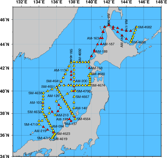
Station Chart
| ● | Stations for hydrographic observation | Station Number: SM-xxxx |
| ◆ | Stations for XCTD observation | Station Number: SM-xxxx |
| ▲ | Stations for subsurface current observation | Station Number: AM-xxx |
| ● | Stations for XBT-DBT observation | Station Number: TM-xxx |
Area: The Sea of Japan and the Sea of Okhotsk
Period: 27 April 2006 - 29 May 2006
| Data | File name | File type | File size | Last updated |
|---|---|---|---|---|
| Cruise Information | ||||
| Summary of cruise | SM0604.SUM | TXT | 9 kB | 9 October 2009 |
| Station information | SM0604.STN | TXT | 99 kB | 15 March 2007 |
| Oceanographic Data | ||||
| Hydrographic data | SM0604.E | TXT | 273 kB | 14 March 2007 |
| CTD and XCTD data | SM0604.CTD.ZIP | ZIP | 1473 kB | 15 March 2007 |
| Water sample data | SM0604.WAT.ZIP | ZIP | 63 kB | 30 September 2008 |
| Subsurface current data | SM0604.A | TXT | 18 kB | 10 February 2010 |
| Petroleum hydrocarbon and heavy metal data | SM0604.OHM | TXT | 1 kB | 18 October 2013 |
| Floating pollutant data | SM0604.FLT | TXT | 1 kB | 16 October 2007 |
| Tar ball data | SM0604.TRB | TXT | 1 kB | 16 October 2007 |
| Marine Meteorological Data | ||||
| Maritime meteorological data | JIVB2006IM3.TXT | TXT | 127 kB | 6 June 2011 |
| Aerological data | SM0604.AER.ZIP | ZIP | 11 kB | 15 March 2007 |