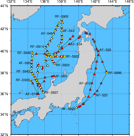
Station Chart
| ● | Stations for hydrographic observation | Station Number: RF-xxxx |
| ◆ | Stations for XCTD observation | Station Number: RF-xxxx |
| ▲ | Stations for subsurface current observation | Station Number: AF-xxx |
| ● | Stations for XBT-DBT observation | Station Number: TF-xxx |
Area: East of Honshu and the Sea of Japan
Period: 21 October 2016 - 06 December 2016
| Data | File name | File type | File size | Last updated |
|---|---|---|---|---|
| Cruise Information | ||||
| Summary of cruise | RF1608.SUM | TXT | 16 kB | 30 November 2017 |
| Station information | RF1608.STN | TXT | 56 kB | 10 April 2017 |
| Oceanographic Data | ||||
| Hydrographic data | RF1608.E | TXT | 218 kB | 30 January 2026 |
| CTD and XCTD data | RF1608.CTD.ZIP | ZIP | 1256 kB | 10 April 2017 |
| Water sample data | RF1608.WAT.ZIP | ZIP | 71 kB | 27 February 2026 |
| Subsurface current data | RF1608.A | TXT | 25 kB | 5 April 2017 |
| Greenhouse gas data | RF1608.WAY | TXT | 68 kB | 2 October 2017 |
| Petroleum hydrocarbon and heavy metal data | RF1608.OHM | TXT | 1 kB | 10 April 2017 |
| Floating pollutant data | RF1608.FLT | TXT | 1 kB | 10 April 2017 |
| Tar ball data | RF1608.TRB | TXT | 1 kB | 10 April 2017 |
| Marine Meteorological Data | ||||
| Maritime meteorological data | JGQH2016IM5.TXT | TXT | 269 kB | 5 April 2017 |
| Aerological data | RF1608.AER.ZIP | ZIP | 21 kB | 10 April 2017 |