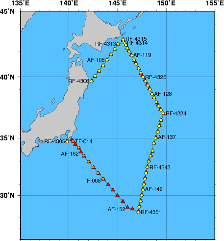
Station Chart
| ● | Stations for hydrographic observation | Station Number: RF-xxxx |
| ◆ | Stations for XCTD observation | Station Number: RF-xxxx |
| ▲ | Stations for subsurface current observation | Station Number: AF-xxx |
| ● | Stations for XBT-DBT observation | Station Number: TF-xxx |
Area: East of Honshu
Period: 06 March 2012 - 25 March 2012
| Data | File name | File type | File size | Last updated |
|---|---|---|---|---|
| Cruise Information | ||||
| Summary of cruise | RF1202.SUM | TXT | 18 kB | 30 November 2017 |
| Station information | RF1202.STN | TXT | 46 kB | 24 December 2014 |
| Oceanographic Data | ||||
| Hydrographic data | RF1202.E | TXT | 165 kB | 28 December 2016 |
| CTD and XCTD data | RF1202.CTD.ZIP | ZIP | 1034 kB | 11 March 2014 |
| XBT-DBT data for standerd depth | RF1202.T | TXT | 2 kB | 21 June 2012 |
| XBT-DBT data | RF1202.BT.ZIP | ZIP | 25 kB | 21 June 2012 |
| Water sample data | RF1202.WAT.ZIP | ZIP | 36 kB | 28 December 2016 |
| Subsurface current data | RF1202.A | TXT | 17 kB | 21 June 2012 |
| Greenhouse gas data | RF1202.WAY | TXT | 42 kB | 29 June 2021 |
| Petroleum hydrocarbon and heavy metal data | RF1202.OHM | TXT | 1 kB | 5 April 2013 |
| Floating pollutant data | RF1202.FLT | TXT | 1 kB | 5 April 2013 |
| Marine Meteorological Data | ||||
| Maritime meteorological data | JGQH2012IM5.TXT | TXT | 251 kB | 18 July 2013 |
| Aerological data | RF1202.AER.ZIP | ZIP | 19 kB | 21 June 2012 |