The Japan Meteorological Agency (JMA) has conducted ongoing ship-based hydrographic observation along the 137°E meridian across the western North Pacific since 1967 (the year after R/V Ryofu Maru Ⅱ came into service) for winter and since 1972 for summer, providing an unprecedented body of periodical observation data covering more than 50 years for this oceanographic section. The 137°E section stretches from 34°N south of Japan to 3°N off New Guinea, crossing major currents such as the Kuroshio, the North Equatorial Current (NEC) and the North Equatorial Countercurrent (NECC) as well as major water masses such as the Subtropical Mode Water (STMW), the North Pacific Tropical Water (NPTW) and the North Pacific Intermediate Water (NPIW) in the subtropical and tropical gyres. Temperature and salinity data from the section are widely used by domestic and overseas researchers as well as by JMA researchers and scientists to clarify seasonal-to-decadal variations and long-term changes of currents and water masses in relation to climate variability factors such as El Niño-Southern Oscillation and Pacific Decadal Oscillation. The data represent a valuable scientific resource not only for analysis of large-scale long-term oceanic variability in the northwest Pacific but also for validating the reproducibility of oceanic variations in global warming prediction modeling. To facilitate and encourage the use of historical long-term observation data, JMA has released the Oceanographic Section Time-series Dataset (for temperature and salinity) based on analysis with gridding and unification in defined intervals with data collected by JMA research vessels and other interpolated observation results.
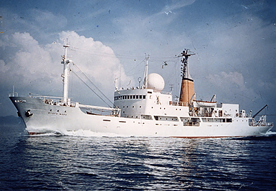 |
R/V Ryofu Maru Ⅱ The Ryofu Maru Ⅱ operated the 137°E hydrographic section from 1967 to 1995. Two research vessels are currently used for observations (the Ryofu Maru Ⅳ and the Keifu Maru Ⅱ). |

|
Stations contributing to the time-series dataset of the 137°E repeat hydrographic section
Hydrographic stations (red circles) and the main ocean current system. |
The vertical sections here show examples of analysis data.
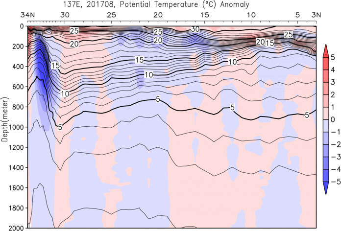
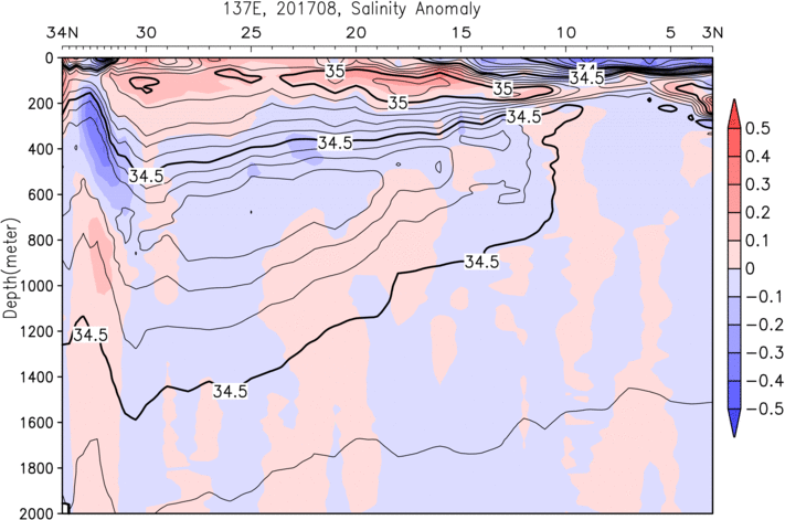
Vertical sections of temperature (left) and salinity (right) for summer 2017
Contours indicate analysis values (temperature: thick/thin lines for 5°C/1°C; salinity: thick/thin lines for 0.5/0.1) colored to represent anomalies from the average (red: above average; blue: below average).
* The average value is the averege for 30 years from 1991 to 2020 each winter and summer.
"Observation Data", "Oceanographic Section Time-series Dataset" and "Sections" are archived separately in zip files.
"Observation Data" are raw temperature, salinity, oxygen, nutrients and other materials data collected by JMA research vessels.
"Oceanographic Section Time-series Dataset" contains statistically analyzed grid point values based on observation data and other interpolated monitoring information.
"Sections" are vertical sections based on the Oceanographic Section Time-series Dataset and winter/summer average of temperature and salinity.
The above data may be updated after recalculation.
The following citation should be included to cite the datasets :
Kawakami, Y., A. Kojima, K. Murakami, T. Nakano and S. Sugimoto (2022): Temporal variations of net Kuroshio transport based on a repeated hydrographic section along 137E. Climate Dynamics, doi:10.1007/s00382-021-06061-8