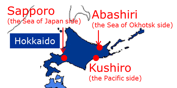
Figure 1 Location of Sapporo City, Abashiri City, and Kushiro City
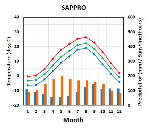
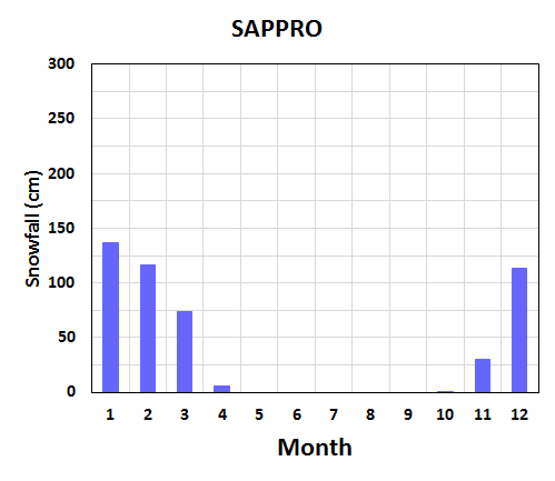
Figure 2 Seasonal variation of meteorological elements in Sapporo City
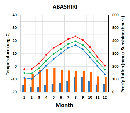
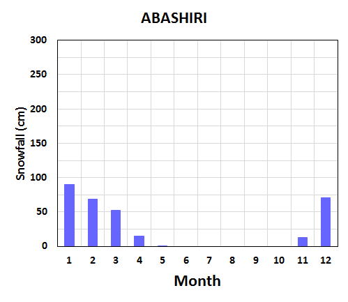
Figure 3 Same as Figure 2 but for Abashiri City
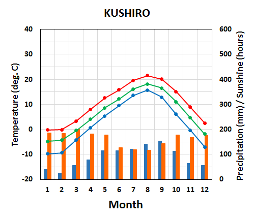
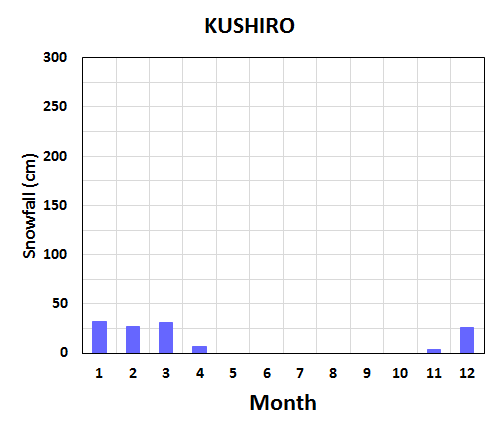
Figure 4 Same as Figure 2 but for Kushiro City Winter (December-January-February)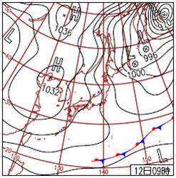
Figure 5 Weather chart for 00UTC on 12 December 2012 In winter (December-January-February), the Siberian High develops over the Eurasian Continent and the Aleutian Low develops over the northern North Pacific. Prevailing northwesterly winds cause the advection of cold air from Siberia to Hokkaido and bring heavy snowfall to the Sea of Japan side of Hokkaido (upstream of mountainous land) and sunny weather to the Pacific side (downstream of mountainous land). Temperatures as low as -20°C are frequently observed in inland areas. When sea ice reaches the Sea of Okhotsk side of Hokkaido, the area is very cold. Spring (March-April-May)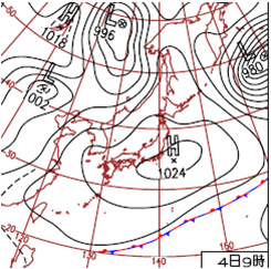
Figure 6 Weather chart for 00UTC on 4 May 2006 In spring (March-April-May), migratory cyclones and anticyclones that alternately move eastward prevail across Japan. Temperature increases (decreases) in front (back) of cyclonic systems due to warm southerly (cold northerly) flow. Temperature in Hokkaido rises gradually with large short-term variations. The sunshine duration is the longest in the second half of spring due to the predominance of anticyclonic systems. Summer (June-July-August)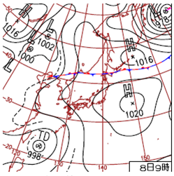
Figure 7 Weather chart for 00UTC on 8 August 2010 When the North Pacific High extends northwestward around northern Japan, it brings warm and sunny conditions to Hokkaido. Temperatures as high as 30°C are frequently observed in inland areas. The Foehn phenomenon also sometimes causes temperatures of 30°C or above on the Sea of Okhotsk side. Sea mist forms on the Pacific side when moist air transported by southerly winds is cooled by the ocean's cold Oyashio Current. Precipitation amounts in Hokkaido increase in August due mainly to the activity of fronts, though the Baiu front that forms from June to July hardly affects the region's weather. Autumn (September-October-November)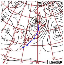
Figure 8 Weather chart for 00UTC on 23 October 2012 In autumn (September-October-November), temperatures in Hokkaido fall gradually and cyclonic/anticyclonic systems move eastward across Japan alternately. The frequencies of cold northwesterly flows across Japan and snowfall on the Sea of Japan side of Hokkaido show an increasing tendency. |