Updated on 5 Mar. 2026
Japan Meteorological Agency
The column inventory rates of oceanic carbon dioxide (CO2) between the sea surface and σθ = 27.2 kg·m-3 (a depth of about 1000m) along 137°E, 165°E and 24°N since the 1990s are approximately 5–11, 3–11 and 7–10 tC·km-2·y-1, respectively.
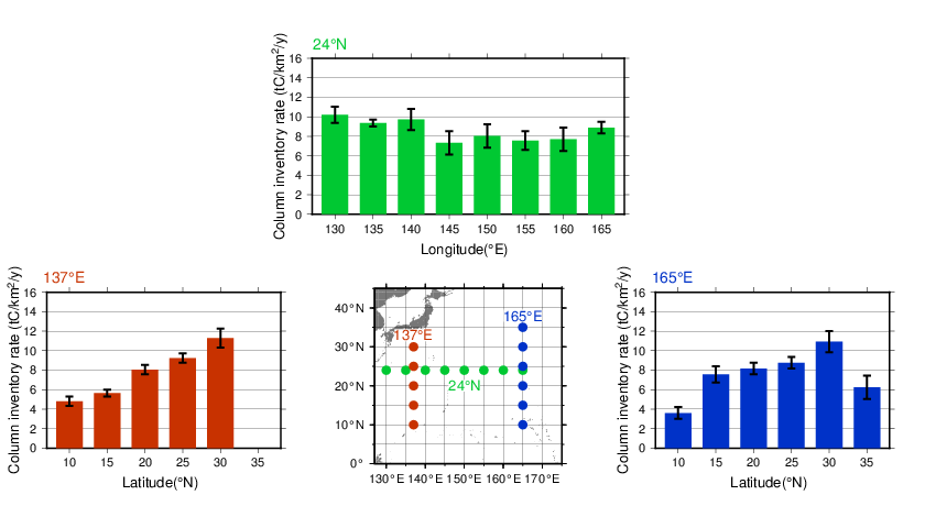
Column inventory rates of oceanic CO2 between the sea surface and σθ = 27.2 kg·m-3 (a depth of about 1000m) along 137°E, 165°E and 24°N since the 1990s. Error bars denote a 95% confidence level.
The column inventory rates of anthropogenic CO2 in the western North Pacific were estimated as 4–8 tC·km-2·y-1 using high-quality hydrographic section data sets from the 1990s and 2000s (Kouketsu et al., 2013).
The column inventory rates of oceanic CO2 (Canth.) were estimated using long-term time-series data on dissolved inorganic carbon since the 1990s (Ishii et al., 2010).
The column inventory rates of oceanic CO2 between the sea surface and σθ = 27.2 kg·m-3 along 137°E, 165°E and 24°N since the 1990s are approximately 5–11, 3–11 and 7–10 tC·km-2·y-1, respectively. The rates around 20–30°N are higher than those at other latitudes.
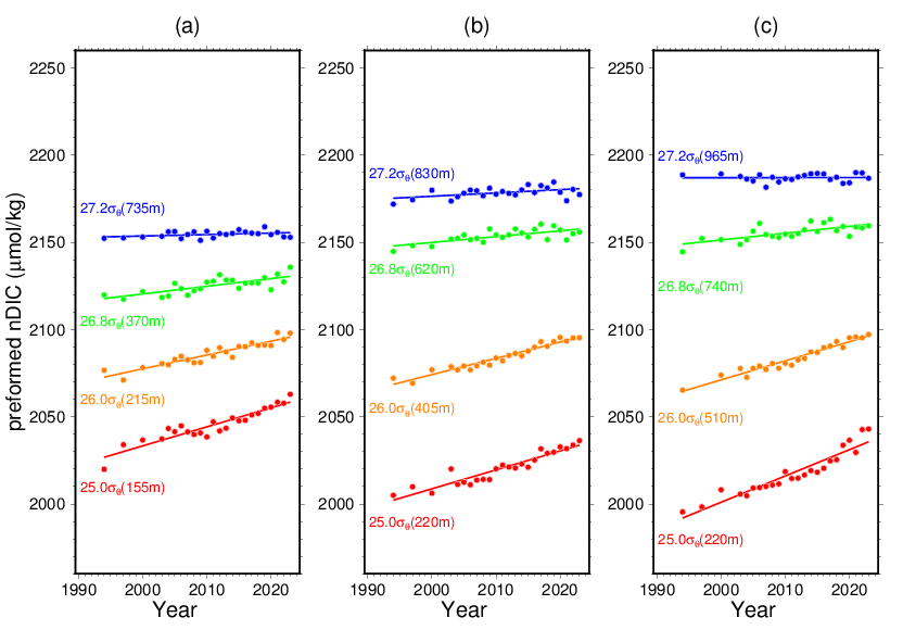
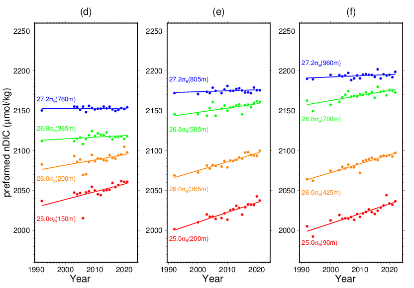
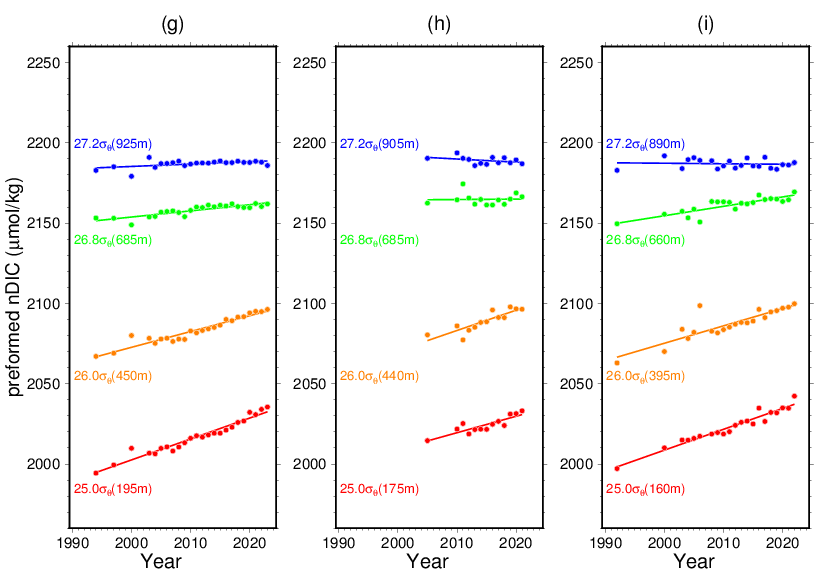
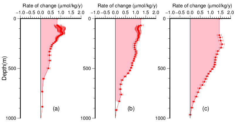
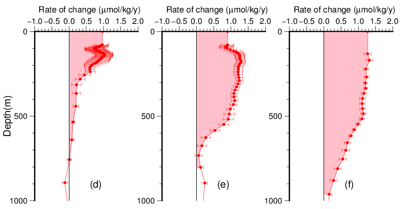
Long-term trend of preformed nDIC on isopycnal surfaces.
(a)10°N·137°E, (b)20°N·137°E, (c)30°N·137°E, (d)10°N·165°E, (e)20°N·165°E, (f)30°N·165°E, (g)24°N·135°E, (h)24°N·150°E, (i)24°N·165°E
Values in parentheses denote the approximate depth in density.
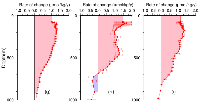
Rate of Canth. between the sea surface and σθ = 27.2 kg·m-3 since the 1990s
(a)10°N·137°E, (b)20°N·137°E, (c)30°N·137°E, (d)10°N·165°E, (e)20°N·165°E, (f)30°N·165°E, (g)24°N·135°E, (h)24°N·150°E, (i)24°N·165°E